
On the Explorers Way from Darwin via Alice Springs (Uluru) to Adelaide
Of the Explorers Way leads from the north to the south of Australia. From Darwin we drive over the Litchfield and Kakadu National Park. Pass through Nitmiluk and Katherine Gorge to follow through the endless expanse of the Australian outback Alice Springs to get. The Road of Explorers takes us to Kings Canyon and Uluru-Kata Tjuta National Park. Via Coober Pedy we reach the Flinders Ranges, the Clare Valley, Barossa Valley and at the end Adelaide.
The path also brings us from the hot tropics through the red heart and finally a winter break. Temperatures of 35 – -2 degrees are then no rarity when traveling through Australia.
The last leg of my 3 month trip to Australia brings me to the Northern Territory and Top End. From Broome we flew to the tropical Darwin. After the road trip from Adelaide to Perth, then along the west coast from Perth to Broome it goes for 14 days by camper from Darwin through the northernmost region of Australia: The Top End! Litchfield National Park, Nitmiluk National Park (Katherine Gorge), Kakadu National Park, and Arnhemland. Then it’s back to Darwin.
After a short break, start three weeks on Explorers Way from Darwin via the Red Center (Alice Springs) back to the exit to Adelaide. Alice Springs, Kings Canyon, Uluru, Flinders Ranges stand on our route on the Explorers Way. For the last few weeks we have rented another camper again.
More tips for a trip to Australia:
Caution: Do not underestimate the size of Australia in your planning. If you have little vacation and time, you should think carefully for which route you decide. Also, the additional cost of one-way rental for rental cars or campers you must not forget.
I hope this article helps you to plan your route!
What awaits you in the Northern Territory?
When you talk about the Northern Territory, most people think of that Australia’s landmark Uluru (formerly Ayers Rock), Alice Springs and probably the most beautiful National Park in the Northern Territory: Kakadu National Park.
But this region has much more to offer. That’s why I traveled to this region for a few weeks. Hot springs, mangrove forests, endless deserts, flooded roads and deep insights into Aboriginal art and culture are just some of the reasons to visit.
Especially the old rock paintings (rock art) of the Aboriginals and their genesis pull me into the spell.
 Angbangbang Gallery in Nourlangie. This rock painting is one of the best known in the Kakadu NP. More impressive you will find in Arnhemland.
Then there are these after the rainy season roaring waterfalls that pour into crystal clear crocodile-free pools and invite you to swim (eg Florence Falls, Buley Rockholes or Wangi Falls in Litchfield National Park). The hot capital is called Darwin and convinces with night markets (Mindil Beach, right on the beach) or its good seafood at Stokes Hill Wharf.
Stokes Hill Wharf – Tip in Darwin for good and relatively cheap seafood
Deep gorges can be explored by boat or kayak in Nitmiluk National Park. A helicopter tour offers a better view of the Katherine Gorge.
 View into the Katherine Gorge from Lookout near the Cicada Lodge for sunset.
Nowhere is camping more beautiful than in the national parks in the Northern Territory. This should be at least a tour with Aboriginal companies to learn more about their culture. A helicopter sightseeing flight is available in the Kakadu National Park on (Highlight). Alternatively (and cheaper) by the Katherine Gorge in Nitmiluk National Park or of course around the Uluru and Kata Tjuta on.
I could not resist it and did all three helicopter flights.
My highlights and worthwhile stops on the way Explorer’s Way from Darwin to Adelaide
After we flew from Broome to Darwin (the Gibb River Road was unfortunately still closed), we explored Darwin relaxed for two days, received our camper van and bought in the supermarket for the next few days road trip in the Top End.
Darwin
Tropical hot capital of the Northern Territory
Darwin is not only the capital of the Northern Territory, Darwin is also one: tropical hot! The heat and high humidity after the rainy season reminds me of Bali. No wonder Darwin is closer to Asia than any other major city in Australia. The climate here is probably not good for everyone.
Nevertheless, Darwin is somehow a perfect place to arrive in Australia. For my companion (brother Michi) so ideal to get used to the climate and the time change.
The city itself does not have much to offer in our opinion. A stay of 1-2 days is enough. Due to the proximity to the Gibb River Road (unfortunately still closed to us) and the wonderful National Parks Litchfield, Kakadu and Nitmiluk Darwin is the ideal starting point for a road trip in the Northern Territory. Either on the Gibb River Road to Broome, Alice Springs and Uluru or once completely from north to south to Adelaide, our destination.
What few people know is that Darwin’s port is twice as big as Sydney Harbor. Unfortunately, he lacks the great view of the opera. There are also saltwater crocodiles and, depending on the season, poisonous jellyfish that make swimming in the sea impossible.
For this, the city has created two natural pools in the harbor area to offer its inhabitants at least natural swimming pools.
Darwin is best known for its markets. Above all, the Mindil Beach Sunset Market (Thursdays and Sundays from May) is worth a visit. Here you can get great street food at fair prices. We were there on one of the first Thursdays in May, it was very busy, but we liked it very much.
If you are not in Darwin on any of the days, visit Mindil Beach to catch the sunset.

In addition, the well-known Injalak Art Center from Arnhemland offers a booth with wonderful native Australian art. Must see. Fortunately, I made it to the original in Arnhemland (later more).
If you can speak of a scene, Darwin’s Waterfront is the place to be. There are numerous shops, cafes and restaurants. In addition, the above-mentioned swimming pools, which were created in the sea with nets to protect against jellyfish and crocodiles.
In the evening, pay a visit to Stokes Hill Wharf. Here are some restaurants for all tastes and budgets. Especially the Asian snacks offer good seafood for under 20 AUD. The portions are large and the view in the evening towards the city or the sea are beautiful.
Stokes Hill Wharf – Tip in Darwin for good and relatively cheap seafood
Further tips follow in detail.
Further information and tips for Darwin:
- Accommodation in Darwin: Be >
Litchfield National Park
The inhabitants of Darwin are lucky, the most beautiful national parks are almost on the doorstep. The closest is the one Litchfield National Park, only 90 km outside of Darwin.
But the “little brother” of the Kakadu National Park is so different from this, because it offers many more opportunities for swimming, because the pools are crocodile-free. I have twice spent two nights each on the campsite of Litchfield Tourist Park. We spent a whole day in the free national park and have all opened in May pools, waterfalls and short walks.
 Florence Falls in Litchfield National Park. First, you can enjoy this view from the lookout.
  … then into the pool of the Florence Falls
I read a lot of times that you should definitely visit Litchfield if you only have one day for the Darwin National Parks. That may be true, but I strongly recommend, also time for the Kakadu National Park plan (read on for my highlights in Kakadu NP).
Tips for the Litchfield NP in one day:
- Visit the termite mounds “Magentic Termite Mounds” (Compassermites) and the up to 6 m high “Cathedral Mounds”.
- Wangi Falls – the beautiful waterfalls with the largest pool. Unfortunately there was a crocodile in the pool at our visits. bathing forbidden
- Greenant Creek – short hike up to the pools you usually have for yourself.
- Bathing at Buley Rockhole – many tourists but nice.
- Hike from Buley Rockhole to Florence Fall (1.2 km). First to the lookout, then down to the pool to take a dip in it.
- Tolmer Falls Lookout
All 4WD roads (eg Tjaynera Falls, The Lost City) were at my be >We would have liked to visit these. But with a 2WD Campercan we should not have driven here anyway.
More tips about Litchfield National Park:
- Campsite at Litchfield Tourist Park: Pitch with electricity for 38 AUD per night
- At the entrance to the park are information boards that indicate closed roads. In addition, there is a very good overview map of the park (Tip: either take a photo or download the map of the Litchfield NPs here before the trip)
Caution: Especially on weekends, the park can be very crowded, as the inhabitants of Darwin like to visit Litchfield National Park. Therefore, it may make sense to book campsites in advance and visit the park early in the morning. The swimming pools are the fullest in the midday heat. From 15 o’clock it gets emptier, because then the day visitors slowly disappear.
Tomer Falls, Litchfield National Park. Unfortunately you can not swim here. Greenant Creek in Litchfield National Park
Kakadu National Park
For me, the most beautiful and varied National Park in the Northern Territory for me is the Kakadu National Park. At the entrance from Katherine we thought at first that it looks kinda boring. Because of the dense vegetation and many trees you can not see anything at all.
But the further you drive into the park, the more impressive and diversified the landscape becomes. Instead of just three, we stayed in the park for six days and still have not seen everything.
My highlights in the Kakadu National Park, which can be reached without a tour (which were already open and accessible after the end of the rainy season):
- Ubirr: Ancient rock paintings and a view from the Nadab Lookout especially just before sunset, the one around. It was so nice that we were here twice.
- Warradjan Aboriginal Cultural Center: Really beautiful museum, which tells and explains the life of the Aboriginals based on many citations and stories of the inhabitants.
- Nourlangie (Burrunggui): Along a 1.5 km long circular route you will pass many rock paintings that are already several thousand years old.
- Nawurlandja Lookout: Offers you a superb view of Nourlangie
More tips on Kakadu National Park:
- Visit the Bowali Visitor Center to find out which streets and places are closed. You will also get information about the condition of the roads and the tides for the transitions into Arnhemland.
You will also be perfectly advised on activities for your planned time in the park. Here we got great tips and maps with lots of information material. - refueling: Definitely in Katherine, fill up on Darwin. Shortly before the park entrance at the Mary River Roadhouse the dispensers were defective (coming from Katherine), as well as the Bark Hut Inn Roadhouse closed. Where this looked rather abandoned (coming from Darwin). There are plenty of opportunities to recharge your batteries in the park: Cooinda Lodge Kakadu, Jabiru and the Aurora Kakadu Resort.
- Campsites in the park: There are numerous campsites in the park. We looked for a current. In Jabiru the us Camp site at Kakadu Lodge & Caravan Park (46 AUD per night) best liked. The campsite at the Cooinda Lodge Cockatoo (41 AUD per night) was much louder and the mosquitoes due to the situation in the world countries were superior to us. The washrooms were not clean.
- Accommodation in the park: Here we have two nights in Aboriginals operated Anbinik Kakadu Resort spent. Here you can find the cheapest accommodation if you are not traveling with a camper or RV. The cabins have a private bathroom with outdoor shower, a small terrace and cooking facilities next door.
- A Taste of Cockatoo Festival: The Interactive Food Festival always takes place in May. We happened to be there for 11 days during the festival. Information is always available here on the website of the park.
Angbangbang Gallery in Nourlangie. This rock painting is one of the best known in the Kakadu NP. More impressive you will find in Arnhemland.  We fly to the Jim Jim Falls – unbelievably beautiful experience!
Arnhemland – Day trip to the land of the Aborigines
Arnhemland covers nearly 100 km² of untouched nature and one of the most remote areas of Australia.
“You have to go to Arnhem Land, only here you can feel the spirit.” – all these were just words. Until my visit. Since then, my head is buzzing. I want to hear more stories, see more of the country and learn more about culture, rites and rock art.
Arnhelmland is managed by Aboriginal tribes (Bininj) who have lived here for over 60,000 years. Visitors need a permit to visit Arnhemland. However, this only allows to visit the settlement Gunbalanya and the local Injalak Art Center. Individual travel is not possible.
Only in the context of a day trip (eg Arnhemlander Cultural & Heritage Tour) can be reached from Jabiru in Kakadu National Park in Arnhemland. Well, we did that and fortunately got a “quiet” day. With our guide Ryan we were only 8 people. This gave us the opportunity to reach places and places that he does not show or show to everyone. Sometimes the groups are too big, too unfit for the others.

To get to the ancient murals (Rock Paintings), you have to climb one or the other rocks. It was worth it. For hours I could sit in front of the rock paintings, which are much more recognizable in Arnhemland and larger in size. There are no barriers and so we can sit in front of it or lie on the floor (many paintings are painted on the ceilings in caves) and puzzling over what can be seen on the paintings.
Even Ryan could explain us only some of the paintings. Only a few of the older Bininj could probably interpret us, what can be seen, if the story has been handed down to it.
The next highlight is a visit to the Injalak Art Center in Gunbalanya. As I was able to see works of art from Arnhemland in Darwin and Nitmiluk National Park, I did not expect much new. I should be wrong. Many artists can be found in the Art Center, who are painting their pictures, making didgeridoo (Yidaki would be more correct) or printing fabrics with their designs.
Even though the artists are shy – which is often due to the lack of English vocabulary – they are happy to ask them about their artworks. Graham showed us his current project and explained the story to us. Later, I bought several of his wonderful works of art in the gallery. Of course he insisted on posing with it.

If you arrive individually (with Permit you can only visit the Injalak Art Gallery, nothing else), you can pre-book the Rock Art Tour at Injalak via the website. Unfortunately we did not have time for these. But the many great places we were able to visit during the day during the tour were already overwhelming and impressive.
At the end of the tour, Guide Ryan even took us to a burial site no 20 yards off the road (ok piste would be the more appropriate term). In order to pay respect we should not take pictures here. He also did not want to tell stories about the human bones lying around there. He was not sure if the stories were correct. No rumors. OK. Still a weird feeling to be in such a place.
After that everything went very fast and suddenly we were back to Cahils Crossing and then back to Jabiru, from where we started in the morning.
Further tips for visiting Arnhemland:
- Day tours to Arnhemland: At Arnhemland 4WD Cultural & Heritage Tours book for 273 AUD. Departure is Jabiru. The tour is great and really worth it. The provider is 100% owned by Aborigines, the groups are small.
Website of Arnhemland Cultural & Heritage Tours. - Injalak Art Center in Gunbalanya (Oenpelli) is open Monday – Friday from 8 – 17 clock and Saturdays from 9 – 14 clock. Closed on Sundays and bank holidays.
- Rock Art Tour by Injalak Arts: The tour takes about 3 hours and costs 110 AUD.
You need to get permits from the Northern Land Council (see next point).
Tour on the Injalak Arts website. - Permits for Arnhemland You can get it from the Northern Land Council in Jabiru by calling (08) 89383000 or by visiting the website online.
Nitmiluk National Park (Katherine Gorge)
The Nitmiluk National Park (formerly Katherine Gorge) belongs to the Jawoyn Aboriginal People. They manage both the Cicada Lodge, the adjacent camp site as well as various boat tours on the flight in the Katherine Gorge (gorge). The Katherine River has made its way deep through sandstone cliffs, forming this gorge.
The best way to explore the gorges is by kayaking. Since we were at the beginning or middle of May (I was twice) in Nitmiluk National Park for one night on site, the river was still closed to kayaking. The rainy season was long and there were still a few saltwater crocodiles in the river. A pity.
Cultural boat cruise on the Katherine River
I would like to recommend the Cultural Cruise to everyone. The local Jawoyn explain a lot about their traditions, tools as well as rock art on the rocks. In the normal tours by boat (led by whites) you get this information and stories are not told.

Lookout for sunrise or sunset
Just a few minutes walk from the jetty lies the Lookout, which offers you a great view of the gorge at sunrise or sunset. I was here on both visits to Nitmiluk for sunset. Beautiful!
View into the Katherine Gorge from Lookout near the Cicada Lodge for sunset.

Scenic flight over the Katherine Gorge
For regular readers of my blog it is no secret anymore: I love helicopter flights! So I did a Scenic Flight at Nitmiluk Heli Touring over all 13 gorges! It’s worth it and was once again an experience in itself!
 Scenic flight over all 13 canyons of Katherine Gorge

Katherine (Nitmiluk NP) to Daly Waters
Distance: 276 km
The drive from Nitmiluk National Park or from Katherine to Daly Waters is quite monotonous. Nevertheless, there is a place where everyone should stop: Bitter Springs in Elsey National Park. The thermal springs are located in the middle of a small rainforest. Suddenly there are palm trees on the left and right and the landscape is completely changed.
Bitter Springs at Mataranka
The Bitter Springs are less frequented than the hot springs in Mataranka (located at the Homestead and mentioned in each guide).
The stop was well worth it, the springs are pleasantly warm (about 30 – 34 degrees), the water is crystal clear and thanks to the current, you can just drift along the river to the exit. Afterwards you are refreshed and can continue the way to Daly Waters.
On the way there would still be in Larrimah the Pink Panther Hotel, which is already announced miles on the pink boards. Everything is really pink here. But we continue.
Daly Waters Pub – supposedly the oldest pub in the Northern Territory
In Daly Waters, we are not astonished: The pub is definitely worth a visit. We thought all the guides and other travelers exaggerated. The pub itself is a collection of curios: bras, underpants, shoes, driver’s licenses, police badges, caps, traffic signs, and what else do I know? Incredible!
That just here – in the middle of nowhere – the campsite is full and we get hold of the very last place with electricity, I would not have believed. Honestly not. We do not travel to the main season, and in the last 2 months there were still plenty of places left. But everything is different here. Crazy and fascinating.


As soon as a live band arrives, the pre-order for the meal (Half Barra – half steak, salad as much as you want) is only possible at 19.30 – which is quite late for Australian standards. But we are late, other “slots” already booked.
A musician entertains all guests with country music (especially Johnny Cash, yeah), from 22 o’clock is night rest! We and a few Wallabies are the only ones who are still awake after 11pm. But the Milky Way can be seen very well with the eye, so we take pictures. By the way, this is the first time in weeks (Perth?) That I have to freeze and wear a sweater.
 The night sky over Australia’s Outback definitely beats Africa!
More information about the Daly Waters Pub and the camp site
- Campsite powered (32 AUD) and unpowered campsites as well as small cabins can be rented. You can reserve in advance only as a larger group. First come, first serve. At 5 pm we were lucky. But it’s a Saturday, maybe less is going on during the week. I dont know.
Daly Waters to Devil’s Marbles, Wauchope
Distance: 522 km
After supposedly 3 km you reach the ghost town Newcastle Waters and the famous Junction Hotel. This was assembled in 1932 from old windmills. However, it only takes about an hour’s drive. Since we had to turn, we leave the detour and continue.
The drive from Daly Waters to Wauchope brings even less variety than yesterday. Again and again WWII memorials, for which we do not stop.
In between, we represent our legs on the way:
 Roads in the outback are long and straight
Actually we want to go to Tennant Creek today. With about 3000 inhabitants, the city is the only “bigger” city between Katherine and Alice Springs. When we arrive is only 14 o’clock, besides, we have no desire for city. Therefore, we continue to the Devil’s Marbles.
Overnight we booked a campsite with electricity for 30 AUD. Showers and toilets are clean, the campsite manageable and quiet.
Devil’s Marbles
The Devil’s Marbles or “Karlu Karlu” or Karlwekarlwe are sacred aboriginal towns in the Outback (specifically, the tribes of the Warumungu, Kaytetye, Anmatyerre and Alyawarre). It is said that the Rainbow Snake has laid its eggs here, the Devil’s Marbles.
Karlu Karlu means “round object”. According to tradition, the rocks are the eggs of the rainbow snake from the Dreamtime. Therefore, this is an important place for ceremonies and should therefore be treated with respect. Signs indicate that you should not climb on the stones. Unfortunately, only a few people stick to it. It is very sad that most visitors are not concerned with the place and its meaning.
In my imagination I had a few round stones in my head. On our arrival, not only me, but also my brother are relatively speechless. Because the area of the spherical granite rocks is huge. Over 1000 stones are distributed here on a large area. The round rocks were shaped by weathering and erosion.
You can walk around on one way around the rock formations. Please respect the desire of the Aboriginals and do not climb like many other visitors ON the stones.
 Devil’s Marbles from above. Aboriginals say they are the eggs of the rainbow snake.
  A few of the Devil’s Marbles and I stare in front of it.
Wauchope – Alice Springs (509 km)
Only about 10 km after leaving we stop again. The reason? The Wycliffe Well Roadhouse & Holiday Park. Or the UFO Capital of Australia. Already on the Stuart Highway are funny signs with hints that in front of us a runway for UFOs would be.

 UFO landing pad – Wycliffe Well on the way to Red Center to Alice Springs.
On the way out, there would still be the Barrow Creek Hotel, which, according to some friends, is also “paved” with banknotes pinned to the wall. This sounds similar to the Daly Waters Pub, so we do not pause here and continue to Aileron.
In Aileron we see from afar the 12 m high Anmatjere man, who awakens with his larger than life-sized family about the small town. At the entrance there is an Aboriginal Art Gallery which you can also visit at a stop.
Then we drive directly to Alice Springs on.
Alice Springs – Capital of the Outback
In Alice Springs we explore the pedestrian area with the Todd Mall Markets, a collection of Aboriginal Art Galleries, souvenir shops and cafes.
Just in time for the sunset we drive to the Anzac Hill, a war memorial, to watch the sunset and the Auslock on the city. Unfortunately, the Kangaroo Sanctuary is closed and offers tours from the next day at sunset.
From here you can take a sightseeing flight with the hot air balloon. This we have done at Outback Ballooning (website). An update will be added as soon as possible.
More tips and information for Alice Springs:
- Stay: For one night we stayed in the centrally located Ibis Styles Alice Springs Oasis.
- To eat out: The Rock Bar. Good burger, fast service and within easy reach.
- Tip for a tour: Morning sunset with the hot air balloon over the outback. Provider: Outback Ballooning, 390 AUD. Wonderful!
Landing succeeded, what an experience! Because sunset in a hot balloon in the outback, I can only recommend!

Kings Canyon – Watarrka National Park
Distance Alice Springs – Kings Canyon Resort (Campground): 472 km, about 5.5 – 6 hours driving time
The Kings Canyon is an absolute highlight in the Red Center of Australia. Unfortunately, the Watarrka National Park, with its deep, wide and red glowing canyon, is left by many tourists to the left. You only know one goal here: Uluru. But especially Australian tourists know about the beauty of this canyon.
Incidentally, the rock strata are over 440 million years old. About 20 million ago a fine crack in the plateau, which became wider and wider due to wind and rain.
As we travel in the Australian winter, the Rim Walk (about 6 km) was definitely on our to do list. In the summer at over 40 degrees in the shade, this path is closed early in the morning. Too often people collapse on the steep climb out of the ravine on the edge of the gorge.
We walk around the canyon at a pleasant 18 degrees on the plateau. The wind is strong and offers a comfortable temperature for hiking. Without stress with many photo breaks we go the way and all Lookouts along.
We pass sacred places of the Luritja Aborigines like the water hole in the Garden of Eden. Also parts inside the gorge are sacred and are taboo for us. I like to respect that.
After the walk we still stay, because a ranger offers free lectures to the national park at 15 o’clock. He talks about working with Aboriginals to protect nature, tells us about flora and fauna, and answers questions to anyone interested in the subject. A great opportunity for those who want to know more about the Watarrka National Park.
Tips for Watarrka National Park and Kings Canyon:
- Overnight stay: Kings Canyon Resort. From huts to campgrounds with and without electricity, there is something for every traveler. The good news is that Kings Canyon Resort is 10 km from Kings Canyon. We stayed at the camp site. Unfortunately I have forgotten to confirm my reservation request. Therefore, all powered campsites were gone, we had to get by with a campsite without electricity.
Prices: unpowered Campsite: 20 AUD per person, powered Campsite: 25 AUD per person. - Kings Canyon Rim Walk: This hike leads to a short climb to 100 m along the gorge. He is about 8 km long with lookouts. We needed about 4 hours with a lot of photo breaks (normal about 2 – 2.5 h).
- dingoes: At Kings Canyon Resort you have the opportunity to see a dingo pack regularly. For some a joy, for some a Le >
 Michi at one of the viewpoints along the canyon in Kings Canyon at Rim Walk
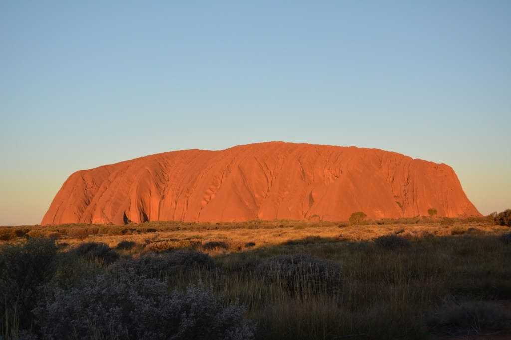
Uluru-Kata Tjuta National Park
Distance Kings Canyon Resort (Campground) – Uluru (Ayers Rock Resort Camp Ground): approx. 305 km, 4 hours driving time
The supposed highlight for every Australian traveler is the Uluru. Friends have already told me how impressive this rock is. The speech is of course Uluru or Ayers Rock as it was once called.
Immediately after our arrival at the campsite “Ayers Rock Campground” we drive to Uluru and walk around the base walk around the monolith.
Field of Light at Uluru
A visit to the Field of Light is a dream come true. Incidentally, the light installation Field of Light was recently extended until the end of 2020. Definitely book tickets before the trip, as they are very popular.
It was bitterly cold, but the lights under the well-visible Milky Way were beautiful. About 1.5 hours we wandered through the sea of lights, before we had to leave with the shuttle bus again.
 Field of Light at Uluru
The next morning we drive with SEIT Outback for sunrise to the Kata Tjuta (formerly Olgas). Here, too, we experience a fascinating play of colors. The rocks – consisting of conglomerate – rise up to 500 meters from the depth.
Kata Tjuta to the sunrise
After a breakfast of warm coffee (it’s only 2 degrees, the night was below 0 degrees), we go the short but windy way to the Walpa Gorge. The path is uneven and leads between two of the rocks into a “dead end”. Walpa means wind in the language of the Anangu Aboriginals. The name could not be more appropriate.
After a short break and hot shower, which I really need, it’s time for the next highlight: helicopter flight over Uluru and Kata Tjuta. Since we will probably only be here once in a lifetime, we decided to book this flight at the Visitors Center the day before. For those who want to see the “nothingness” and the forms of the Uluru and Kata Tjuta again from above in detail and up close: Absolutely take the chance and make this scenic flight.
 The Uluru seen from the helicopter again looks very different than the Basewalk.
  The Uluru consists of vertical rock layers. 2/3 of the mountain (we suspect) are in the ground and not visible to us. Kata Tjuta and the Domes – incredibly impressive and very different from the Uluru.
At sunset, we place ourselves with many other travelers on the National Park Road with a view towards Uluru. The colors are very intense again. Happy and satisfied we drive back to the campsite. The impressions and impressions almost kill me. The Uluru Kata Tjuta National Park is really something special.
 Sunset at the Uluru. Only in certain places may one stop and take pictures.
By the way: The Uluru-Kata-Tjuta National Park is listed by UNESCO as World Heritage Site and World Heritage Site. The park is 1326 square kilometers in size.
Coober Pedy
Distance Uluru (Ayers Rock Resort Campground) – Coober Pedy: 733 km, 8 hours driving time
The drive to Coober Pedy was long. Most travelers put up an overnight stop in Marla. We did not feel like it and changed every hour with driving. At maximum temperatures of 18 degrees, little traffic and regular breaks that was not a problem.
There was not much to see on the ride. The road was partly red, the landscape changed to South Australia from red to more and more green. Along the road we saw four wedge-tailed eagles. Unfortunately too late to slow down and take pictures. The animals are powerful and grow up to 1 meter in size. Very impressive.
 Street signs point toward the mines and oversized vehicles on the highway
Coober Pedy is a small dusty village with only 1700 inhabitants. Most of them live underground in caves called “Dugouts” (Coober Pedy is derived from the Aboriginal term kupa piti, which means “the hole of the white man”).
This has the advantage that in the summer at over 40 degrees, but also in the cold winter in the living caves consistently pleasant 24 degrees.
The entrance to Dug Out B&B looks unspectacular. The inside is beautiful, the temperatures are pleasantly warm.
World capital for Opal and filming location for Hollywood films
The small town is the world capital for Opalvorkommen. About 70% come from here. For Hollywood films Coober Pedy served several times as a location: Mad Max III, Pitch Black or Red Planet were filmed in this desert-like scenery among others.
View of Vin Diesel’s spacecraft from Pitch Black and the town of Coober Pedy.
Not only did we rent into a dugout, but we also visit an opal mime before continuing south. Worth seeing were the underground Serbian Orthodox church, the “The Big Winch” Lookout and of course the abandoned spaceship in Hutchinson Street from the Vin Diesel movie “Pitch Black”.
More tips for Coober Pedy:
- Accommodation:Dug Out B&B, new and cozy furnished accommodation with stunning views of the countryside.
- Opal Mine Tour:Tom’s Working Opal Mine, Adult 15 AUD (self-gu >We visited Tom’s Working Opal Mine. This is what an Opal Mine underground looks like in Coober Pedy.
Flinders Ranges – Wilpena Pound
Not far from Adelaide are the Flinders Ranges. Probably the best known landmark in South Australia is Wilpena Pound in the center of the Flinders Ranges. Despite winter temperatures have therefore stayed at the Wilpena Pound Resort instead of the campsite. At temperatures below zero degrees a good investment. Even if nothing is isolated here and we are freezing at night.
Wilpena Pound looks like a huge amphitheater of rocks and mountains. The best overview you have on a Sce nic Flight. Since we have already done many helicopter flights before we do without. If you have desire, time and money, you should loud other travelers necessarily the expensive day Scenic Flight. It must be gigantic (see pictures on Google).
We preferred to climb in the great forests to Wangara Lookout. From up here we could half guess how the panorama of Wilpena Pound could look from above. Thanks to the sun, the temperatures were pleasant, the trail was mostly in the shady forest (if you travel in the summer, perfect).
Who wants to discover Kangaroos and Wallabies in the wild, is here by the way exactly right. Already on our arrival (unfortunately it was pitch black) we had to drive extremely slowly, because along the road sat over 30 Kangaroos and Wallabies. Wow! All Australia travelers who claim to have seen no live kangaroos during their voyage simply have to go to South Australia. Whether Kangaroo Iceland, Eyre Peninsula, Coober Pedy or Flinders Ranges. I did not have a shortage of live kangaroos and wallabies during my trip.
Also the next day we saw some animals again. A true paradise! The trip was really worth it, even if we still frozen at night thanks to lack of insulation and two duvets.

Further information for the Flinders Ranges and Wilpena Pound:
- Accommodation: Campsite Wilpena Pound or in the expensive Wilpena Pound Resort. Again, the prices for a room are completely overpriced. In Australia you pay for nature, not for luxury. Alternatively, the Rawnsley Homestead is apparently great and a lot cheaper. In warmer temperatures, however, my first choice would have been the campground at the resort.
- Hike: Directly at the Wilpena Pound Resort start various hiking trails in the Flinders Ranges.Am Visitors Center a few meters further you can rent mountain bikes. Since you can not drive with these on the trails, we have waived. All roads were signposted. We are to
Barossa Valley
The Barossa Valley is THE wine region of Australia. From here, about 60% of the production comes from the whole country. We are here in winter and thus after the harvest. Most of the vines are empty, the leaves have fallen off. Therefore, it is not very colorful and colorful at the moment. The streets are all surrounded by beautiful trees. It must look awesome, the trees would bear leaves.
Outside the villages we still find trees that have not lost their leaves:

Nevertheless, this region reminds us of our home Heilbronn. Because here too there are many vineyards. Some of them are only a few meters away from my front door.
The best view is on the Mengler Hill Lookout:

Of course we tested wine and also bought it. Buying wine in Australia is not cheap. Bottles are available in the Bottle Shop from 18 AUD, directly at the winery depending on the quality from 25 AUD.
 The approach to the Chateau Tanunda – palms left, grapevines right.

We stayed in a small cottage which – to my delight – had a fireplace! Not relevant for most people, as they come here in the summer or fall for vintage. In winter, the nights are very cold and can be here at temperatures around zero degrees.
Our little cottage in the Barossa Valley
More tips for the Barossa Valley:
- Accommodation:Tanunda Cottages in the center of Tanuda. There would have been a camp site in the area, but on cold winter nights we preferred these small cozy cottages for 2-4 people (2 bedrooms).
- Best view of the Barossa Valley: Menglers Hill Lookout.
- Wine tasting: We were unfortunately too late for a wine tasting or to cycle the Riesling Trail by bike. Therefore, we stopped at the Chateau Tanunda (beautiful photo opportunity), wine tested and bought.
- Supposedly best pizza: 40s cafe in Angaston. Honestly? No. The pizza was oily, somehow American and the options were not really to our liking. Nevertheless, the hit par excellence at locals and heavily frequented.
- More tips for the Barossa Valley I found here at Adelaidenow.
Adela >
Then the return trip to Adelaide followed. What you can see and do in Adelaide I wrote here: Adelaide tips and highlights
How long should you plan for Darwin and the Top End?
For the Top End I advise you to plan at least three days in the Kakadu National Park. It will take 1-2 days for Darwin, especially to “arrive” and acclimatize. The Litchfield National Park can be viewed in one day and for Nitmiluk also 1 day is sufficient. If you have little time for the trip, you can also leave out the Nitmiluk National Park.
Overall, I advise to schedule at least 7 – 10 days. But it always depends on the travel time and personal preferences. I spent six days in the Kakadu National Park and could have stayed longer, as I found this region (with Arnhemland) to be something very special (see more below).
I stayed at Nitmiluk for a total of three nights, at Litchfield NP for two nights). In Darwin I was in total a week, since I took a little break from the road trip in between (I was a total of three months in Australia on road).
Itinerary for the Top End from and to Darwin
Darwin – Litchfield National Park – Nitmiluk National Park – Kakadu National Park (with Arnhelmland) – Darwin.
- Day 1: Arrival in Darwin
- Day 2: Explore Darwin CBD
- Day 3: Darwin, pick up campervan and shop
- Day 4: Darwin – Litchfield National Park
- Day 5: Litchfield National Park → My tips & See highlights for Litchfield National Park
- Day 6: Litchfield National Park – Nitmiluk National Park
- Day 7: Nitmiluk National Park
- Day 8: Nitmiluk National Park – Kakadu National Park
- Day 9 – 14: Kakadu National Park
- Day 15: Kakadu National Park – Darwin
Before I drive the route through the Red Center (Kings Canyon, Alice Springs and Uluru), I schedule five days of rest in Darwin. Not because the city is so beautiful, but because my brother (with whom I drive the last part) had a small date chaos and can not arrive sooner.
Itinerary Explorers Way from Darwin through the Red Center to Adelaide
We ourselves had very little time for this section. The “Explorers Way”, as this route is also called, can be visited in 10 days with many highlights. We have a total of 18 days to drive from Darwin to Adelaide. Here I will add, which stops we have inserted and where you can possibly save even with a shorter travel time something to still travel stress-free.
- Day 16: Darwin – Campervan pick up, shop and drive to Litchfield National Park (Litchfield Tourist Park)
- Day 17: Litchfield National Park → My tips & See highlights for Litchfield National Park
- Day 18: Litchfield National Park – Nitmiluk National Park
- Day 19: Nitmiluk National Park – Daly Waters
- Day 20: Daly Waters – Wauchope (at Devil’s Marbles)
- Day 21: Wauchope – Alice Springs → View travel report for Alice Springs
- Day 22: Alice Springs – Kings Canyon
- Day 23: Kings Canyon → See the Kings Canyon report with tips
- Day 24: Kings Canyon – Uluru
- Day 25: Uluru → See complete report on Uluru and Kata Tjuta
- Day 26: Uluru – Coober Pedy
- Day 27: Coober Pedy – Wilpena Pound (Flinders Ranges)
- Day 28: Flinders Ranges
- Day 29: Wilpena Pound – Barossa Valley
- Day 30 – 33: Adela >
Car rental or campervan for the Northern Territory?
The question was quickly resolved for us: Campervan. Why? It is much more flexible, has beautiful campsites to choose from and saves a lot of money. Campsites with electricity cost about 41 – 46 AUD. An accommodation in the national park partly over 300 AUD per night.
For the “small” 15 days Top End Roadtrip I rented a small camper from Apollo together with Susi (Black Dots White Spots). Since we have decided only a week before to book a camper, all 4WD campervan were already gone. Luckily we got another Endeavor Camper at Apollo. There was even a 20% discount due to some action.
For the three weeks through the Outback, where I am accompanied by my brother, we rented a larger campervan (Euro Tourer) early. This provides us with a heater, because in the Outback and Red Center it can during our trip (May – June) come at night to single-digit temperatures. In addition, it is almost straightforward, because you can drive around with a larger camper.
 (Follow pictures and info with prices to the vans)
When is the best travel time for a trip in the top end?
It is best to visit the Northern Territory in the dry season between May and September. If you travel to several regions of Australia, you should think carefully in which order he places his route. I am e.g. Launched in mid-March in Adelaide (beginning of autumn) and reached Perth and Broome to Darwin. Thus, I came shortly after the end of the rainy season in the Northern Territory (early May).
Northern Territory in May – June
The north is tropical, hot and the humidity is extremely high. Even during the dry season. At the beginning of May it was almost unbearable, and before sunset the mosquitoes came like a plague. When I arrived back in Darwin after two weeks of national parks, it was a lot more bearable.
in the Kakadu National Park In May many roads (especially 4WD and the crossings to Arnhemland) are closed or impassable. Shortly after our visit to Kakadu National Park, the roads to Jim Jim Falls, Twin Falls and Gunlom Falls were opened. Too bad, I would have liked to visit them all from nearby. There are no helicopter flights to the waterfalls in the dry season.

in the Litchfield National Park In early May, the access and walk to the popular Wangi Falls was closed for maintenance. All 4WD roads were also still locked.
in the Nitmiluk National Park In May you could not rent kayaks or swim because the river was still being searched for crocodiles and was not yet released.
From the temperatures, the travel time was perfect. At night, temperatures dropped below 30 degrees, with average temperatures around 33 degrees a day. Only briefly climbed the thermometer about 36 degrees. Also, all the waterfalls were beautiful, as they led a lot of water. During the dry season, most waterfalls are less impressive, either dehydrated or just a trickle.
Now you are spoiled for choice!
Roadtrip checklist and travel diary
I guarantee you will not forget anything Checklist for a road trip created.
My further tip: Writing travel diary would be your trip!
The memories in it are the most beautiful gifts of your journey! That’s why I designed and printed my own travel diaries.
In these notebooks you can enter costs, weather, impressions, highlights and travel experiences. There is also space for pasting pictures. Ideal as travel memories.
My personal travel diaries for city trips, road trips and holidays. With tips to write yourself.
Would you like to miss any more information from me??
Related Posts
-
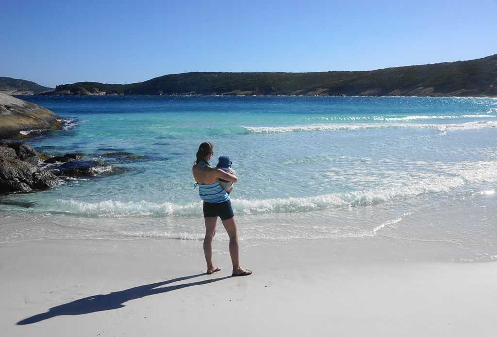
Traveling with baby during parental leave – adventure australia
Site: passenger-x.de Traveling with baby during parental leave – Adventure Australia Franzi and her friend have been proud parents since October 2017….
-
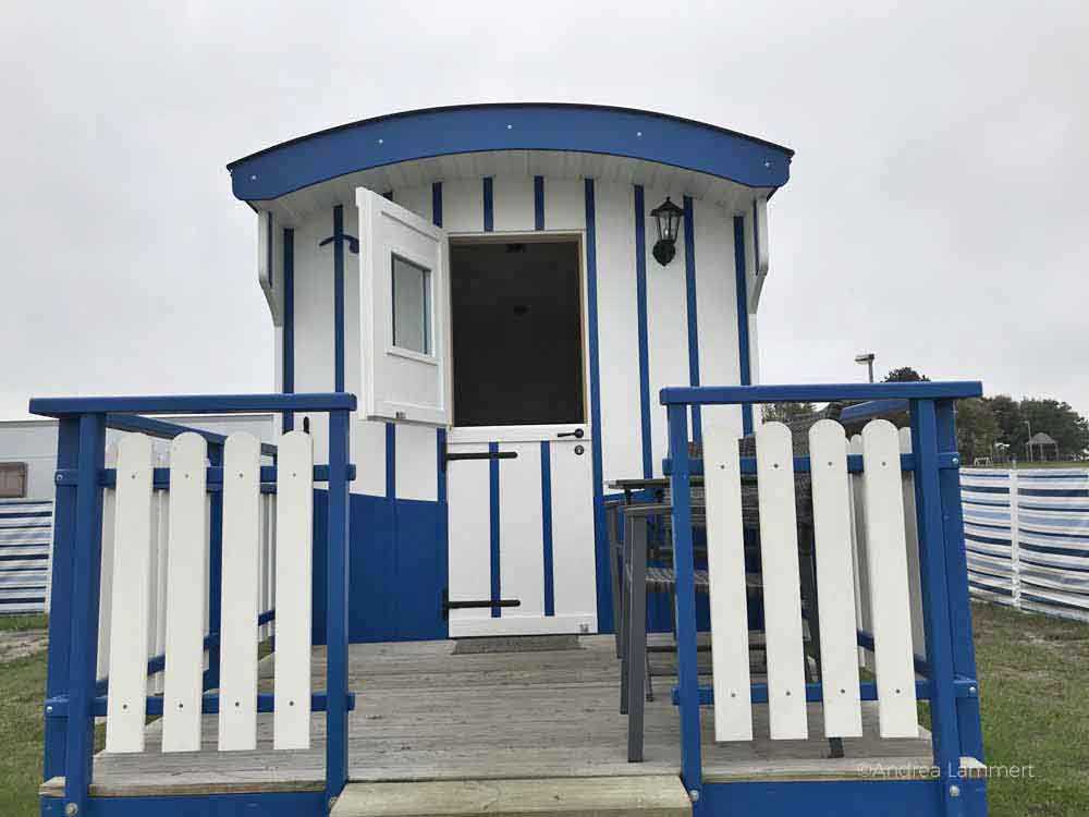
Tips for a holiday in dangast on the north sea
Friesland: Tips for Dangast If there is an artist village on the North Sea coast, then it is probably Dangast. It exudes a very special atmosphere with…
-
Australia travel tips – travel blog mini globetrotter
Australia Travel Tips Our second home is Australia Dream destination Australia! For us Australia was home for 13 years. From Sydney, we have extensively…
-

Sights in the Altmühltal An overview of the most beautiful sights in the Altmühltal : Actually, the Altmühltal is already a sight in itself: A small…